Our software solution reached one of the busiest metropolis in Europe: London. TopoCrew Ltd is a well-established survey company that works in most boroughs of London, delivering one of the highest-quality survey products in the market using traditional total station workflow combined with laser scanners. We are proud to be part of their success.
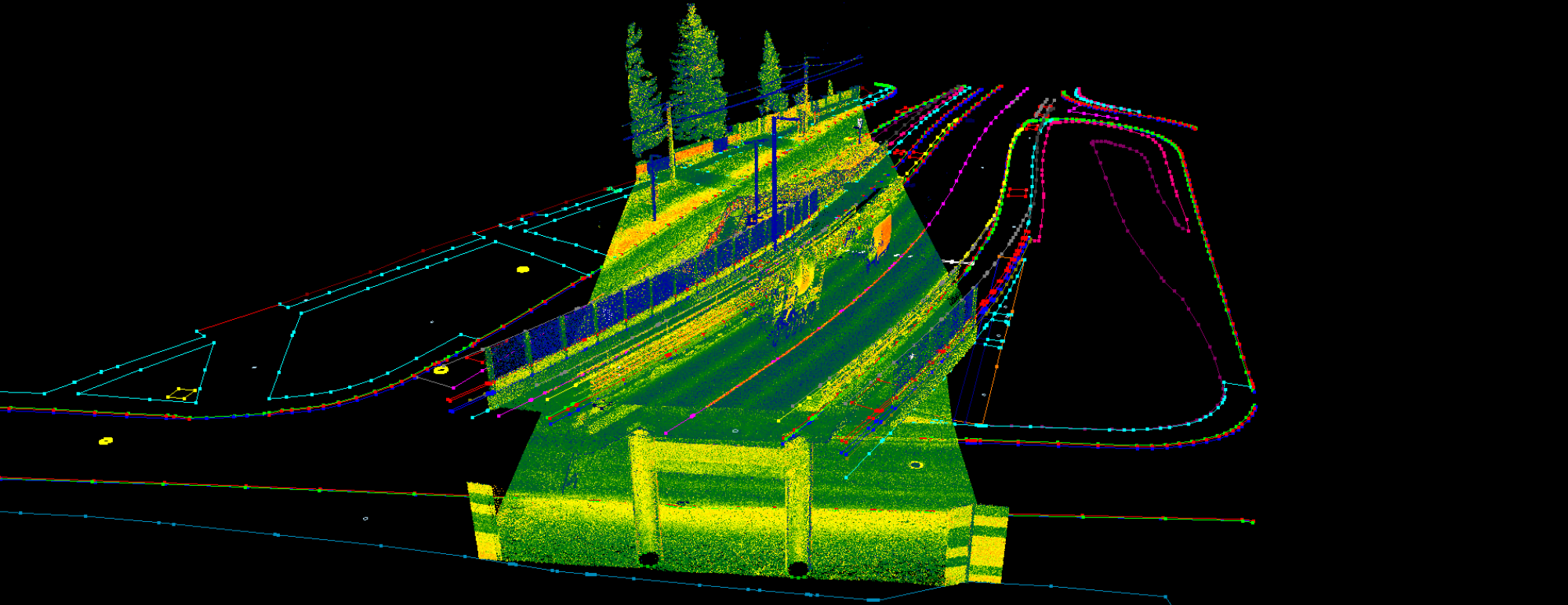
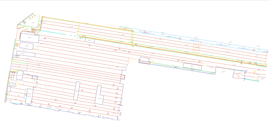
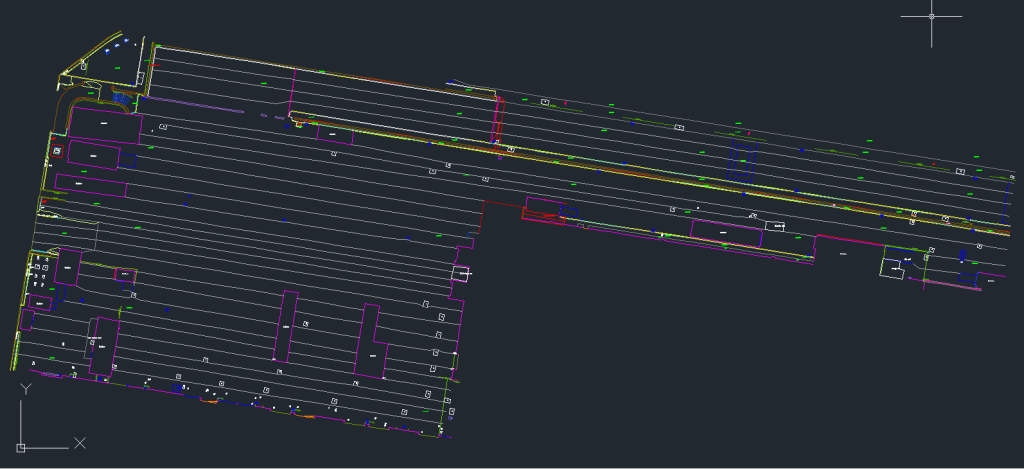
TopoCrew adapted the PCS software and workflow in 2023, just before the Holborn Liveable Neighbourhood Scheme for the London Borough of Camden project started. As the project has a 150.000 sqm area, effectively extracting the vectors was crucial for the company. PCS kicked in, and the whole project has been extracted using our toolkit. For the following projects, PCS has been part of the daily workflow for TopoCrew, and since then, hundreds of thousands of square meters of downtown London have been extracted using it.
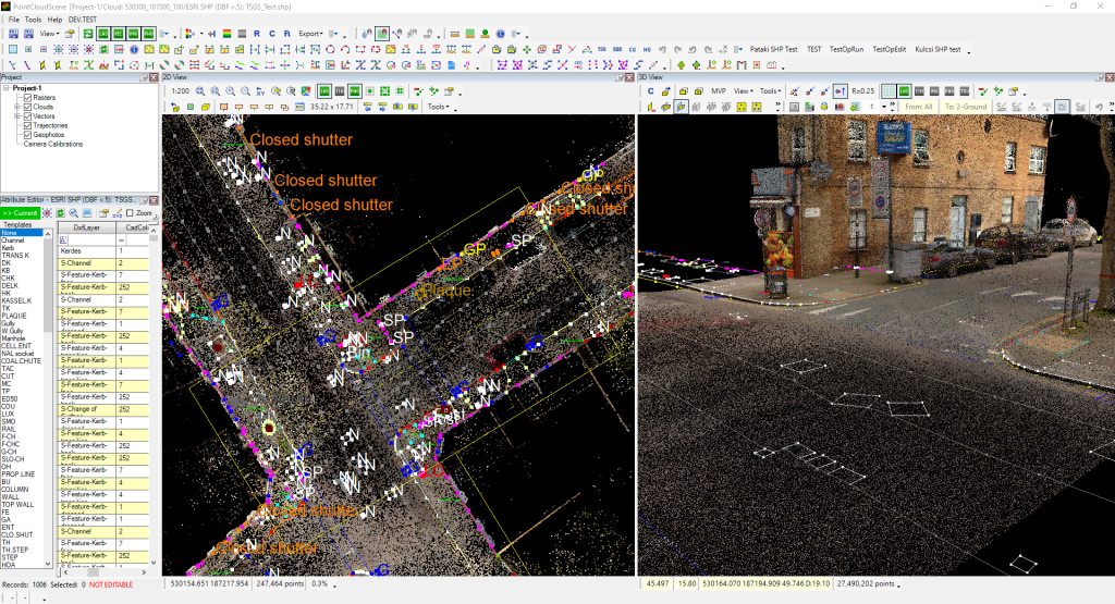
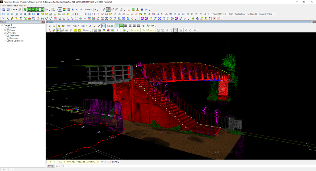
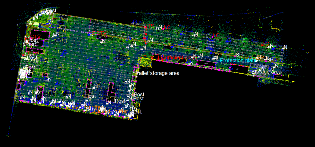
TopoCrew uses a Leica RTC360 TLS system and a Navvis VLX SLAM system to support or replace the total station surveys on site to reduce field time and enhance the existing technology with PCS’ GIS-based extraction method. This approach opens a new way for drawing automation solutions and effectiveness enhancements within the company. Based on the ‘PCS approach’, the company developed its survey system (TSGS – Topocrew Survey GIS System), which allows the extraction of the vectors in a GIS environment and the export of the vectors straight to a CAD system, with minor adjustments to the already existing survey methods.

TopoCrew is trusted by significant civil engineering companies around London, such as WSP and FM Conway, and multiple London Boroughs work with them (City of London, City of Westminster, Kensington and Chelsea, Hammersmith and Fulham, to name a few) because they know that the quality can be trusted.
PCS enables TopoCrew to become future-proof as the trends show that more and more governmental and market organizations are switching from CAD-based solutions to GIS-based ones. With PCS, TopoCrew can serve both audiences with the required output with the currently available toolkit without significant investment.
TopoCrew surveyors are part of London’s everyday life, and we are happy to participate in their success. Keep up the excellent work!
Are you interested in knowing if PCS has the tools you need? We enrolled the PCS Wiki, where you can check if the software would suit you!
Stay tuned for our further blog post by following us on Linkedin!
Would you like to try our tool? Or do you have a question? Hit the Contact Us at the top of the page!