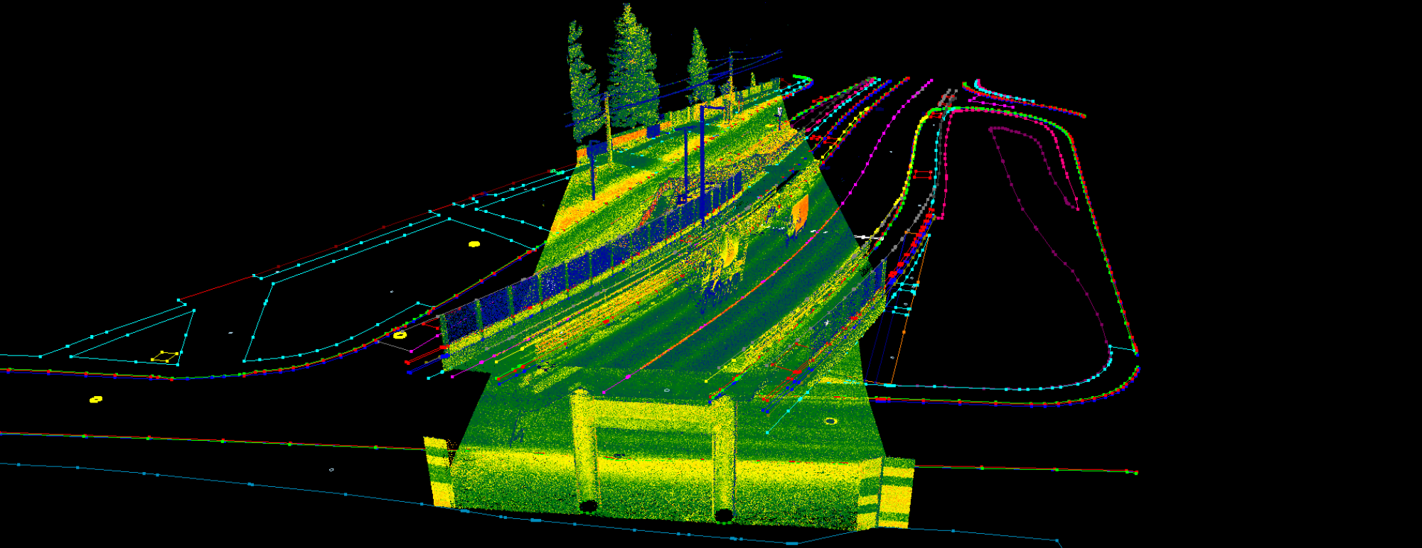
PCS was conceived as a GIS-focused application. From its inception, the primary goal was to develop a tool capable of extracting database information from large point cloud datasets, seamlessly integrated with rasters and scanner images (GeoPhotos). This approach has proven invaluable for building large-scale databases from MLS datasets and for extracting detailed information to support smaller-scale GIS systems.
In addition to GIS extractions, PCS quickly developed its CAD capabilities, enabling users to perform the same data extractions within the same environment. This functionality is particularly valuable for bridging the gap between land surveyors and GIS specialists, who typically work in different environments and often lack familiarity with each other’s workflows. PCS ensures that both sides can utilize the same extraction process, fostering easy collaboration and data consistency.
How is this achieved? PCS uses a fixed attribute structure that enables the software to convert SHP files directly into DXF or DWG formats. These attributes define the key characteristics of each CAD element, including layer, color, block scale, line weight, text height, and more, ensuring that the extracted data is ready for use in a CAD environment without additional adjustments.
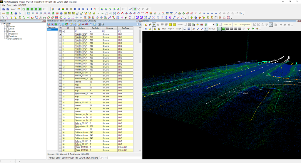
The CAD-structure attributes in PCS are pre-defined, allowing users to assign them with just a few clicks. Since CAD and GIS operate using different logics, not all CAD elements can currently be handled in PCS, and a single point in a SHP file may represent multiple CAD elements, such as points, texts, or blocks. For a detailed overview of the CAD elements supported, please refer to the PCS Wiki Guide.
The GIS approach makes attribute management straightforward by organizing data in a table format, where columns can be reordered or filtered based on specific criteria. Users don’t need to learn all the attributes, thanks to the software’s template functionality. Templates allow pre-defined attribute values to be selected from a template explorer, automatically filling the attributes during extraction. Think of it as a layer manager in CAD, where you simply choose the layer you want to work on.
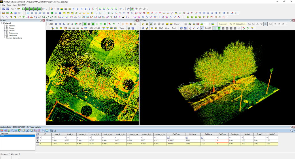
The CAD attribute structure in PCS can be further extended with additional attributes as needed. For instance, when performing a tree inventory extraction, the resulting SHP file can include blocks with extra attributes such as tree geometry parameters. This file can then be exported to CAD or used directly in QGIS or any other GIS application—allowing a single extraction to serve multiple use cases.
When we describe PCS as a bridge, it’s important to note that it’s not a one-way bridge. PCS can also convert DXF/DWG files into SHP files, enabling CAD data to be used seamlessly in GIS environments. During conversion, PCS explodes the CAD file, creates a seed file containing all layer and block definitions, and separates geometries by type into individual SHP files. These SHP files can then be used for extraction, edited, enriched with additional attributes, or exported back to another DXF/DWG file—opening up a wide range of possibilities.
As mentioned earlier, scanner images, ortho photos, and satellite imagery can also be incorporated to further enhance your workflow. Whether you choose to work solely on the GIS side of the extraction or combine all your data for a more complex CAD output, PCS provides the right tools to support you—developed by surveyors, for surveyors.
With PCS, the possibilities extend far beyond simple extractions. By seamlessly bridging GIS and CAD environments, and integrating imagery from scanners, drones, and satellites, PCS empowers users to unlock insights, streamline workflows, and turn complex datasets into actionable results. Whether you’re tackling large-scale surveys, detailed inventories, or intricate design projects, PCS adapts to your needs—making advanced geospatial and CAD work not just possible, but efficient and intuitive. Discover how PCS can transform the way you work, and take your data from raw points to meaningful solutions.
For more info, check our PCS Wiki, where you can find the complete description of all PCS tools, and find out how we can support your workflow!