When I first met with laser scanners, I knew instantly that I want to work with this topic. I think there are others out there, who were also mesmerized to see point clouds for first time in their lives, as I did. It was a wonderful experience, but it took good years to gain the experience and knowledge related to point clouds. Having a scanner and scan buildings, roads or other interesting stuff is just the beginning. You need to extract data from these clouds, which the client can understand, and most of the times, the client is not familiar with point clouds. We need to provide them drawings or database, which they can understand, and this is the part where PointCloudScene kicks in…
The basic statement for PointCloudScene development is the following:
We provide tools to make extraction more effective for the user. We do not automate fully the extraction, because at the end of the day, the automatic solutions need to be checked by the users. It is more effective, if we help the user with effective manual or semi-automatic tools, to make sure, they can extract more information in less time with less effort.
And this is really works!
Finding an effective point cloud extraction tool is hard, I know. CAD based solutions commonly not fit, as GIS based solutions as well. These are not designed for point cloud vector extraction. PointCloudScene is a special tool which has been designed to be a tool exactly for this purpose, and it is one of the most effective software for the task. How do I know that? I worked with PointCloudScene for over 14.000 working hours, in a wide range of projects, and I haven’t met such an effective tool in my career.

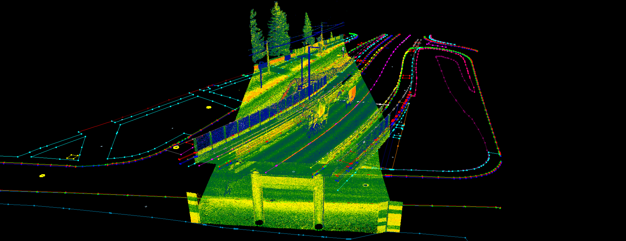
PointCloudScene can handle LAS files from terrestrial, mobile and airborne scanners, even if the dataset is super heavy. The software is capable of visualise points fluently in 3D view above 256 million points. The display can be customized according user needs.

PointCloudScene is more a GIS application than a CAD one. The basic vector extraction is done in SHP files, so the data can be implemented to databases easily, including attributes, which the user can append during extraction. DXF/DWG export also supported, so CAD users can also profit from the benefits of the software.
Above vector extraction, classification is also possible with manual or rule-based semi-automatic tools. The software is also capable for creating annotated datasets for machine learning algorithms, or extract specific features by classes.
Mobile laser scanning nearly always acommpanied by cameras. PointCloudScene is capable of combining these images with point clouds and vectors so all details will be spotted.

I learned from my mentors that, an engineer is a problem-solver, who fixes a solution from the available tools. In terms of point clouds, this software is a must in your problem-solving toolbox. Land surveyors, GIS experts, civil engineers and many other professionals can profit from this software.
Give it a try!
Bálint Molnár
Senior Laser Scanning Specialist